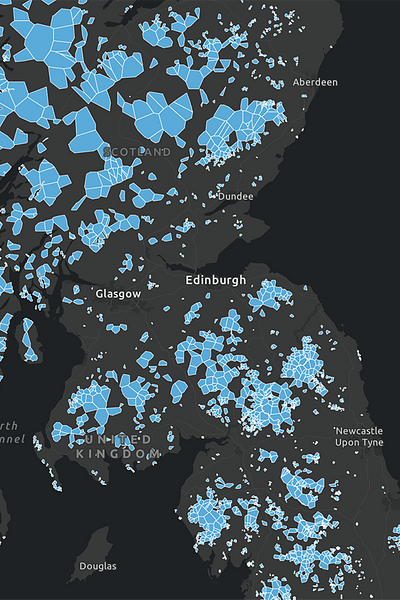
Today we launch our new Mobile Not-Spots map of the UK. We hope it will be a useful tool for organisations planning their services that rely on mobile connectivity. This is especially important for safety-critical services like telecare, traffic controls and telemetry.
The map shows postcode areas in which at least one property is estimated to be unable to obtain reliable indoor mobile signal from any of the UK's mobile networks - a total indoor not-spot. This means no reliable 2G, 3G, 4G or 5G indoors.
Need more granular data?
If you require more granular data of particular roads or premises within different postcodes, we offer independent mobile signal surveys. You can find out more about this service here. If you have any questions about the map itself or require help planning your services that rely on mobile, please get in touch. We've helped many clients with this already.
Connectivity is important. It drives business and society, bringing communities and commerce together. That's why we use our insight and experience to connect people and business.