This constant stream of new information is added to by the data generated from the growing number of Internet of Things devices we use. These huge data sets, when combined with good digital connectivity, are the fundamental building blocks of smart cities and towns.
Real-time information can be used to make informed decisions in all walks of life. For example, if local authorities know which bins are full, which roads are busy and if any emergency pick ups are required, they can then map out the most efficient routes for their waste lorries, saving fuel and resources.
Google Maps determines how busy roads are by gathering information on the number of mobile signals detected on a particular stretch of road. This data is then converted to map out traffic hot spots. This empowers drivers to take action to avoid traffic jams and can prevent worsening congestion.
The vast amount of data we generate can be difficult to process and volumes won’t get any smaller. The complexity and difficulty of getting specific insights from huge swathes of information is like trying to take a sip of water from a fire hose.
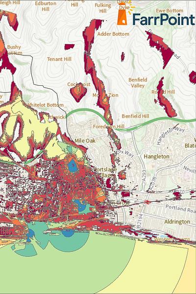
Summarising and visualising patterns and insights from datasets is critical. Most of us are more comfortable reading a map than deciphering a spreadsheet. Geographical information system applications play a key role in processing spatial data into maps we can interact with to make informed personal and commercial decisions.
Moves to make datasets open and available to public and business are being made. There are many benefits to be had from sharing information, from informing customer choices to keeping residents up to date with local news. Companies can see consumer patterns and trends, allowing them to target their offerings better.
It also encourages citizens to engage with urban planning and local authority initiatives. Given access to information in a form we understand, such as a map, we are more likely to interact and give informed opinions on what is happening, or indeed should happen, and keep us involved with the development of our towns and cities. Once we start to interact in this way the data will snowball. If local authorities continue to make the information available through open data initiatives, then it’s only a matter of time before the public sees the benefit of it, uses it and keeps adding to it.
Data privacy concerns are increasingly important so it is essential that the right policies are in place to protect us from misuse of data. All data released should be aggregated so as to protect individual identities.
We are all producing cartography without even realising it. Whenever we use a mobile telephone or a wearable device we are helping to create a map. If this is used wisely, our data could improve our experience as customers and our quality of life as citizens.
Connectivity is important. It drives business and society, bringing communities and commerce together. That's why we use our insight and experience to connect people and business.