

The (this will open in a new window)Connecting Cheshire Partnership, which includes (this will open in a new window)Cheshire East, (this will open in a new window)Cheshire West and Chester, (this will open in a new window)Halton, and (this will open in a new window)Warrington Borough Councils, was established to address the need for better broadband services, particularly in rural and outlying areas where commercial investment was not viable.
The councils needed to understand both fixed broadband and mobile coverage at a granular level, especially in terms of 4G mobile services. FarrPoint built a tool to help visualise and analyse connectivity across the region, helping them better understand and access data on broadband and mobile coverage. The solution needed to display current service availability and support long-term planning by tracking the progress of ongoing projects, such as fibre rollouts and 4G enhancements, to inform future decisions and strategies.

FarrPoint’s expertise and collaborative approach have been invaluable in helping us understand and plan for digital connectivity across Cheshire. Their interactive mapping tool has transformed the way we visualise broadband and mobile coverage, making it easier for us to identify gaps, track progress, and make data-informed strategic decisions. The ability to bring together complex data into a single, user-friendly platform has not only improved our insight, but also enhanced the way we engage with stakeholders and deliver outcomes for our communities.
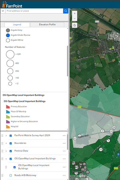
Mike Dugine, Digital Sector Specialist, Connecting Cheshire PartnershipFarrPoint developed an interactive map allowing the councils to visualise and analyse regional connectivity data. This included advising on the best data available to build a complete picture for the Partnerships’ priorities, using a mixture of local information, open data and government-available sources. The FarrPoint team then interpreted and correlated this available data into a format that could be presented in a meaningful way.
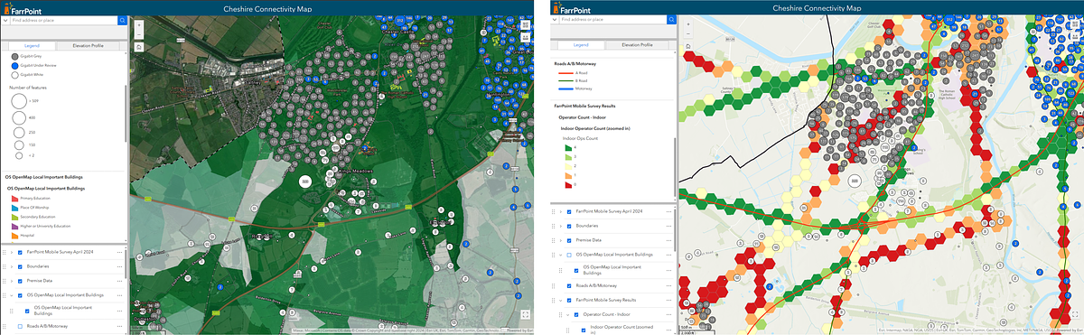
Examples of the Connectivity Mapping on the Portal
The portal was designed to be user-friendly, providing a range of interactive features, including the ability to compare different layers of connectivity data and look at changes over time. The portal enabled the councils to focus on their priority areas, inform strategies and decision-making, and provide tailored information in response to questions from stakeholders and the public. This has also improved team productivity by providing data in one central location, as opposed to cross-referencing information held across disparate systems.
In addition to the mapping portal, FarrPoint conducted mobile coverage surveys to assess 4G and 5G coverage of Chester’s city centre and across the Partnership area. The data gathered from these surveys was automatically integrated into the mapping portal, providing a clear picture of the mobile connectivity gaps and challenges in the area.
FarrPoint also produced a detailed report summarising the findings, highlighting any areas that required attention and then facilitated conversations with the mobile industry to address the gaps.
FarrPoint has helped the Connecting Cheshire Partnership to make more informed, data-driven decisions on future connectivity investments. If you’re looking to gain similar insights into your area’s connectivity needs, please get in touch for a chat.
Connectivity is important. It drives business and society, bringing communities and commerce together. That's why we use our insight and experience to connect people and business.