
.jpg)
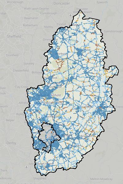
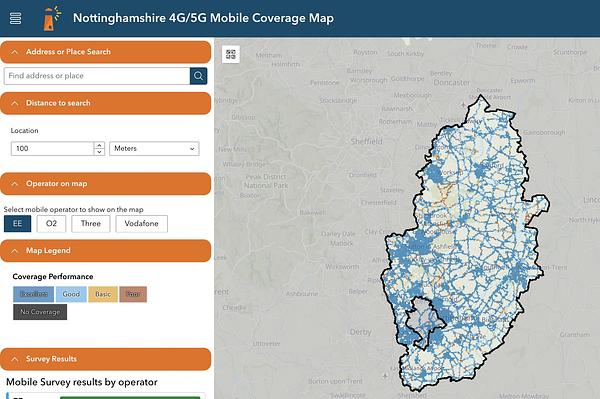
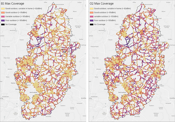
Nottinghamshire County Council wanted to collect real-world 4G and 5G coverage data across the county and display it in an interactive street-level map. Rather than relying only on mobile operators’ predicted coverage maps that often don’t match reality, the survey measured actual mobile signal and residents' experience on the ground. The map is now available through a web-based viewer or GIS system, making it easy for residents to view coverage around the County's cities, towns, and villages.
FarrPoint equipped their vehicle with external antennas to capture coverage and performance tests across Nottinghamshire. In total, 4,728 km of roads across Nottinghamshire were surveyed, giving FarrPoint the ability to cover all possible areas of poor or no coverage. As the roads were driven, signal strength and mobile performance data were collected from all network operators and analysed through an interactive mapping tool.
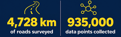
We collected 935,000 data points during the survey, giving us immaculate detail to create an interactive online map for the public. Residents are now able to search by address or postcode to see what mobile coverage is like in their area and compare the performance of different mobile operators.
The map has also been designed to be more accessible, including a colour-blindness-friendly colour scheme, helping as many people as possible understand the information.

This map is vital as we want to make sure our residents and businesses are as well connected as possible and can access accurate information about which mobile phone operators perform best where they live, work and travel. Afterall, many residents need a strong mobile signal for things like accessing health care services, operating smart meters, electric vehicle charging and even on-line shopping, especially for those who may not be able to get out and about. This project as a whole gives us a much clearer understanding of where coverage is working well and where improvements and action may be needed, especially in rural areas where there may be potential gaps in coverage.
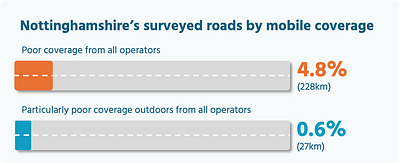
Councillor Bert Bingham, Cabinet Member for Transport and Environment at Nottinghamshire County CouncilThe survey found that 228km, or 4.8% of the roads surveyed, had poor coverage from all mobile operators. Around 27km of roads (or 0.6% of total) had particularly poor coverage outdoors from all operators, meaning a usable mobile service or making voice calls are unlikely.
A coverage performance metric was developed using both speed test results and signal strength data, providing a more meaningful measure of mobile network performance than signal strength alone. Overall, (this will open in a new window)EE was found to deliver the best coverage.

Nottinghamshire County Council has taken a very positive approach by making this information available to residents. Reliable mobile services matter for everyday life, from keeping in touch with family and accessing online services to helping people stay connected in an emergency. Therefore, the council is helping its residents make more informed choices about the best operator in their area. This data can also be used to help identify areas that may be at greater risk of digital exclusion, informing future policy, planning and investment decisions.
Chris Bond, Head of Data at FarrPointFarrPoint's mobile coverage mapper is an autonomous network monitoring solution that provides real-life (not modelled) performance statistics of all available mobile networks. It has been used to map and improve mobile connectivity across the UK and Canada. Contact us for more information on this service.
Connectivity is important. It drives business and society, bringing communities and commerce together. That's why we use our insight and experience to connect people and business.

.svg)